
To me, an urbex location is not an address to tick off a list. Researching it, understanding what a building once was and finding out whether you may photograph it are parts of the same process. A name online is only a starting point.
A nickname is not evidence
Many buildings are given an alias. This offers some protection for the location but also makes research confusing. The same building may have different names on different websites. Conversely, the same nickname may refer to different buildings.
Compare the photographs and architectural features before adopting a history. Window arrangements, structural elements and fixed interior features offer better clues than a movable chair. A match helps assess sources; it does not prove every date or story they mention.
Check the date of a report too. An old photograph may show a building that has since been demolished or converted. A statement that it is “still accessible” may not have been updated for years. The internet preserves such claims longer than an owner keeps the doors open.
Research without using private information
Historical archives, heritage organisations and information from the owner are useful sources for a building’s history. Details in files and letters left behind are not automatically suitable. I do not use legible patient records or private correspondence to expose a hidden location.
A commercial list of coordinates is not an entry ticket either. The person selling an address is usually not the person authorised to give permission for the property. Whether another photographer once went inside says little about your own visit.
Where I draw the line
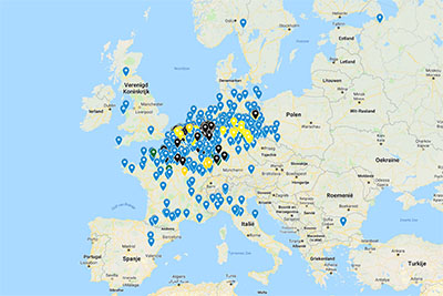
The original coordinate list appears below as part of the earlier account. I do not add directions to entrances or unnecessary identifying details to the photographic reports. Extra restraint is appropriate for houses that are occupied again.
The photographs remain a record of the building and the visit. They are not an invitation to enter closed property. The basics are explained in About urbex, and the legal side in Urbex and the law.
Looking around, with permission
There are also places where industrial heritage is deliberately made accessible. A museum, heritage open day, guided tour or photographic visit arranged with the owner, for example. An interesting series does not need a broken fence in the picture.
Always check the current arrangements and conditions for a visit. They may differ by building and activity. A location officially open to visitors can be at least as interesting photographically as somewhere with a dramatic nickname.
The original locations and coordinates
These entries come from my earlier article. The coordinates remain here as a historical reference. Some locations have since changed, been demolished or been converted. The list has not been verified as current visitor information and says nothing about permission, safety or opening arrangements.
- Gare de Montzen — 50.720665, 5.957739.
- Kent School — 51.208692, 6.307740.
- Salve Mater — 50.855125, 4.777106.
- Landschaftspark Duisburg — 51.480599, 6.783693.
- Beelitz-Heilstätten — listed in the original article without coordinates.
- Former prison in Berlin-Köpenick — listed in the original article without coordinates.
- Camp Hitfeld — 50.734792, 6.134984.
- Lost Tanks — 50.759949, 6.188821.
For an actual visit, check the current situation with an authorised owner or manager. An old pin on a map does not grant access.
nice good work so biutifull spots
Great work
Superdankjewel!!! Daar kan ik mooi mee beginnen.
Ik was in 2019 drie maal in Fort Chartreuse in Luik, dat is pas echt heel groot en je liep er zo naar binnen. wel moet je op sommige etages goed uitkijken want het dak is daar heel gammel, dus je kunt er beter niet lopen als het waait. Je kunt er met de trein goed komen, (liege Guillemins station en dan oostelijk lopen, is ongeveer 40 minuten lopen) ook gooiden mensen die ik niet zag stenen vanaf het dak naar beneden wat natuurlijk ontzettend dom is dus vlak langs de vele gebouwen lopen is ook geen goed idee. maar het is wel heel bijzonder! er zijn veel filmpjes op youtube te vinden.
Daar moet je uitkijken er zitten daar zwervers drugs en zuiplappen ook staan er over al tenten dus ga niet alleen
Idd.. er zijn ook al fotograven mishandeld bestolen en zelfs 1 vermoord daar..dus nooit alleen gaan
Inderdaad goed oppassen daar! Het is een zeer interessant locatie en je kan de hele dag rondlopen en steeds iets anders ontdekken. Er worden stenen naar beneden gegooid, lopen er junkies en dronkelappen. Het dak is in slechte staat en er vallen stuken naar beneden. Op sommige verdiepingen zijn er gaten in de vloer en de gangen waar je 2 verdiepingen naar benede kunt vallen. Zorg dat je goed verlichting bij je hebt zoals een hoofdlamp en altijd boven en onder je kijken als je loopt. In donkere tunnels staan vaak tenten van daklozen en je weet niet wie je tegenkomt. We lipen met een groot groep van 12 mensen en we waren minimaal met 4 samen aan het rondkijken en nooit ver van elkaar. NOOIT alleen gaan is absoluut nodig!
Ja ik heb die tenten gezien, weet niet wie daar bij horen? ik zag er niemand, ook niet rond een tiental tenten die tussen struikgewas stonden.
ik woon in een een stadje en heb daar een paar mooie plekken gevonden
copy en paste deze coordinaten in google maps
1 verlaaten school 51.77075936572197, 5.523272468791518
2 afgebande restourant 51.73317264926981, 5.488360582348678
Ik boezek verlaten plekke
Het restaurant is zo te zien een ruïne he
Restaurant woon ik vlak bij, is enkele weken geleden plat gestoten en wordt een benzine station neergezet.
kent school is inmiddels gesloten en niet meer te bezoeken, is opgekocht door iemand die er iets mee gaat doen.
Hallo hier met david ik ben een urbexer en ik weet dat er normaal geen locaties doorgegeven worden om vandalisme tegen te gaan maar toch ga ik de graag stellen , zijn er soms mensen mede urbexers dat soms nog een locatie hebben ergens in oost vlaanderen gent en omstreken , zou super leuk zijn ik ben zelf nog maar een twee tal jaar bezig met de super leuke hobby en moet zeggen dat het wel een verslaving is , heb je er soms eentje in en rond stad gent laat het mij dan gerust weten via mijn mail ; >com al vast bedankt iedereen !!!!!
Ik heb een lijst van over de duizend locaties…dus…
Wil je ze delen?
Hoi Dave
Een goede 10 jaar geleden bezocht ik met regelmaat urbex locaties in België.
Nu lijkt het mij leuk om weer eens wat locaties te bezoeken.
Maar helaas weet ik na al die tijd geen locaties meer te vinden.
Heeft u voor mij mischien informatie van mooie locaties om te bezoeken?
Graag hoor ik van u.
Met vriendelijke groet Rob Vermeer
wil je die lijst met mij delen?
kan ik deze lijst van je overnemen ?
Hallo heb je toevallig ook wat mooie locaties in Nederland en België voor mij en men vriend we gaan vandaag voor het eerst naar de Veluwe toe naar burning down de house en radiokootwijk we zijn erg geïnspireerd naar verlaten gebouwen en huizen en het verhaal erachter
Vriendelijke groeten joyce en jeffrey
hoi.wil je deze idd delen? ga met mijn petekind deze hobby starten.wonen in zuidlimburg.dus belgie/duitsland…alvast erg bedankt!!
Hallo,
ik ben op zoek naar een lijst met mooie locaties waar ik met mijn dochters op avontuur kan gaan. Ik maak ook graag drone shots.
Zou u de lijst met mij willen delen? Als oud militaire weet ik om locaties achter te laten, alsof je er nooit bent geweest.
Alvast bedankt.
mvg,
Daniel
Beste. Kunt u mij locaties delen van verlaten gebouwen of oude auto’s die verlaten zijn regio west Vlaanderen of oost Vlaanderen
Dank alvast
Wil graag communie foto’s maken van mijn dochter in verlaten gebouwen in West-Vlaanderen zou u mij locaties kunnen door geven a.u.b.
Wil eigenlijk d3 straatnamen weten maar weet nie hoe
Zou je ze misschien met mij kunnen delen?
Hi dave ik ben een beginnende urbexer uit limburg zou je mss eens samen willen gaan of wat locaties uit de buurt hier delen mvg joey
Voor ons huwelijk ben ik op zoek naar een urbex locatie anno 1920. Wie kan er delen? (regio Waregem)
Beste [url=https://uwm.edu/lgbtrc/support/gender-pronouns/]die/hen/hun/mvr/dhr[/url]. Dugardein,
Waar ligt Waregem nooit van gehoord,
Ik kijk uit naar uw reactie.
Met vriendelijke groet,
John Perry
is het mogelijk Urbex in west vlaanderen te delen aub
of andere in belgie
dank u
Urbexmap.NL is ook een website voor te bekijken voor leuke locaties te verkrijgen!
Ik en mij vrouw zijn net begonnen en zijn nu opzoek naar leuke locaties in Brabant om te beginne
Beste,
ik ben met google earth locaties aan het zoeken, ik zoek naar locaties voor met de k2 meter en psb11 , liefste omgeving zuid en noord cq midden limburg. wie kan me helpen aan grote gebouwen, cq woonlocaties.
Dank alvast!, we zijn met 2 personen puur uit intresse.
[quote name=”Urbexmap”]Urbexmap.NL is ook een website voor te bekijken voor leuke locaties te verkrijgen![/quote]
Goeie informatie Marco! Wie weet kunnen we wat voor elkaar betekenen. Wij beheren de website https://www.urbexlocaties.nl
Weet iemand een goede urbex locatie in de buurt van Mol/Dessel/Retie
[quote name=”HOi”]Weet iemand een goede urbex locatie in de buurt van Mol/Dessel/Retie[/quote]